
NE Athabasca Basin
Cree Bay
Key Points of Interest
- Includes ground along the prospective Black Lake Shear Zone and associated electromagnetic conductive horizons.
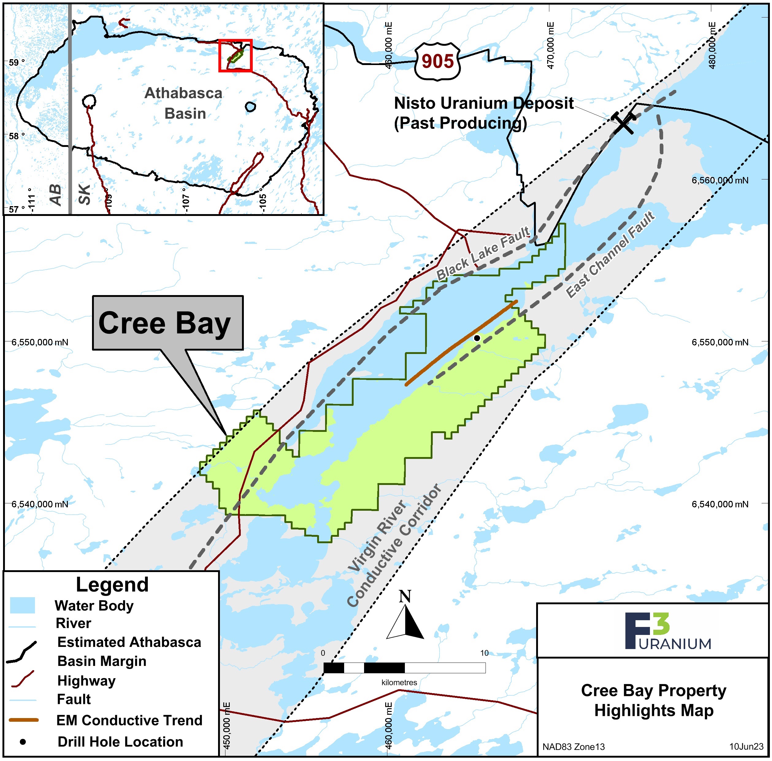
- 15 km southwest of the past-producing Nisto Uranium Mine.
- The newest claims overlie the Black Lake Fault, which marks the boundary between rocks of the Mudjatik domain and the Western Craton. The Black Lake structure can be traced for at least 200km across the entire Athabasca Basin and is associated with Cameco’s Centennial deposit (up to 33.9m averaging 8.78% U3O8 as reported on the Formation Metals website).
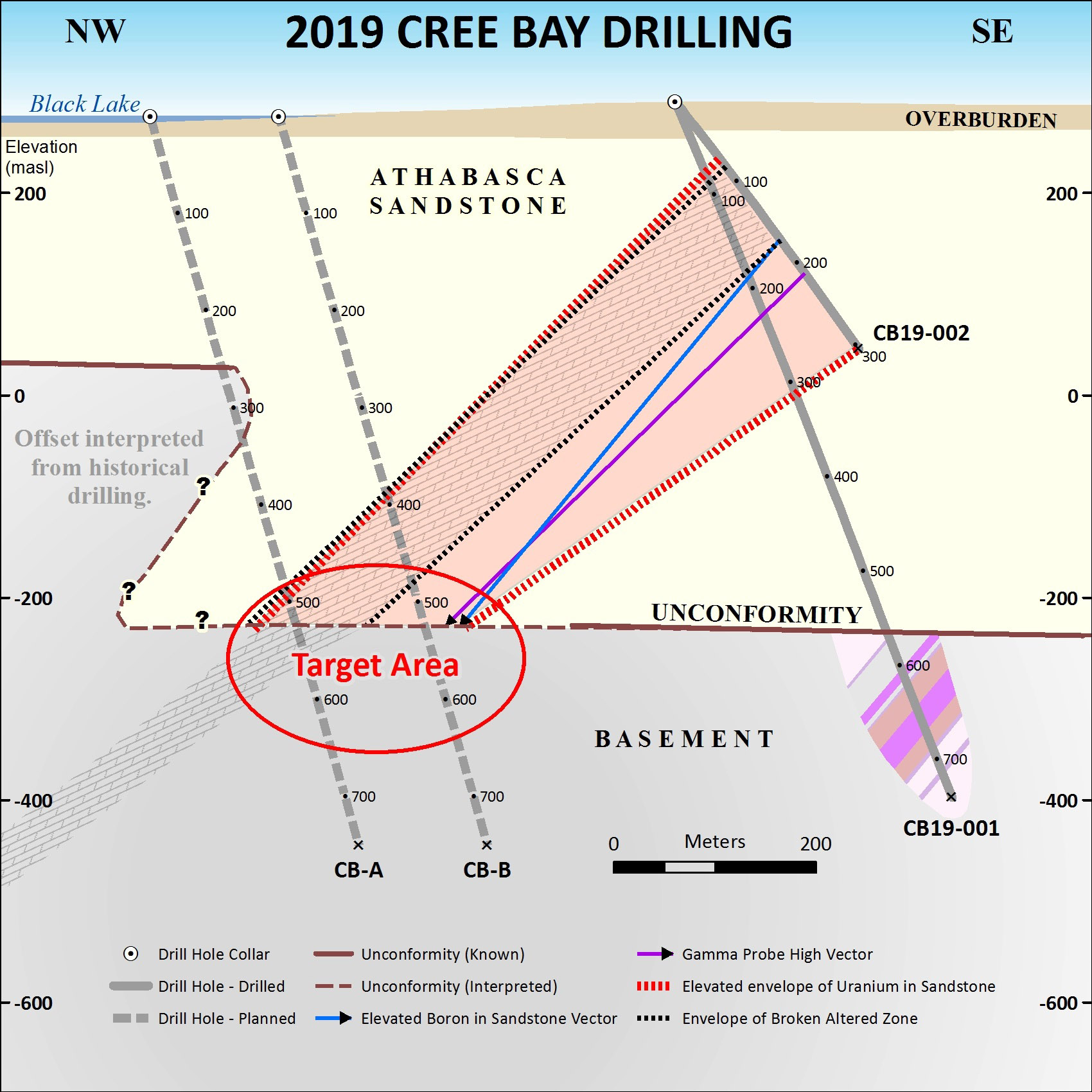
- The unconformity between the Archean rocks of the Hearne Province and the overlying Wolverine Point sediments averages 200m depth from surface.
-
2015 drilling by Forum Uranium 14 km northeast of the property revealed dravite and sudoite clay alteration, quartz dissolution and remobilization, and sulphides deposited well up into the sandstone column overlying a major structural lineament (known as the East Channel). This lineament exhibits a 50m down-drop of the sandstones, and is interpreted to strike southwest onto the Cree Bay property.
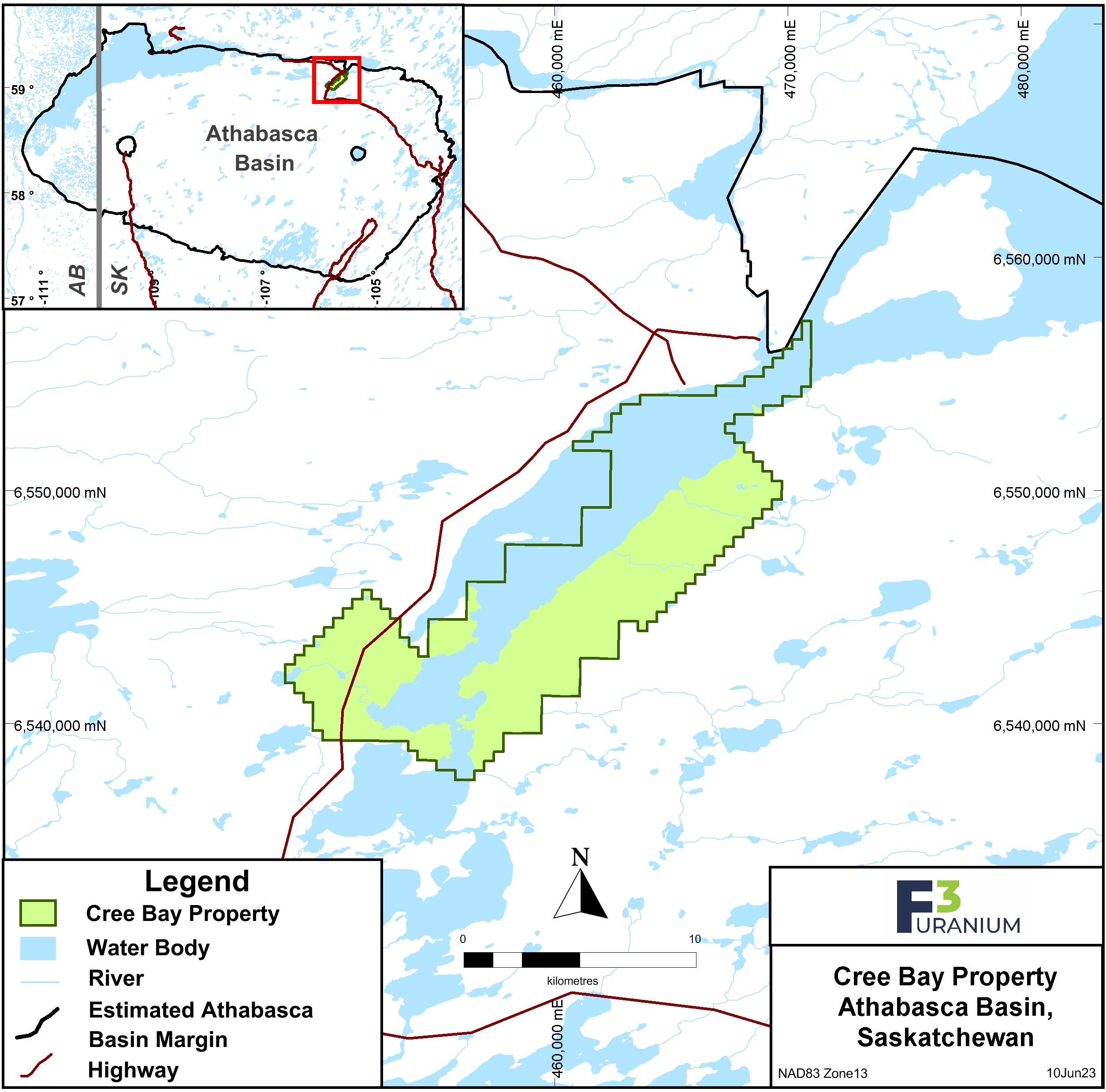
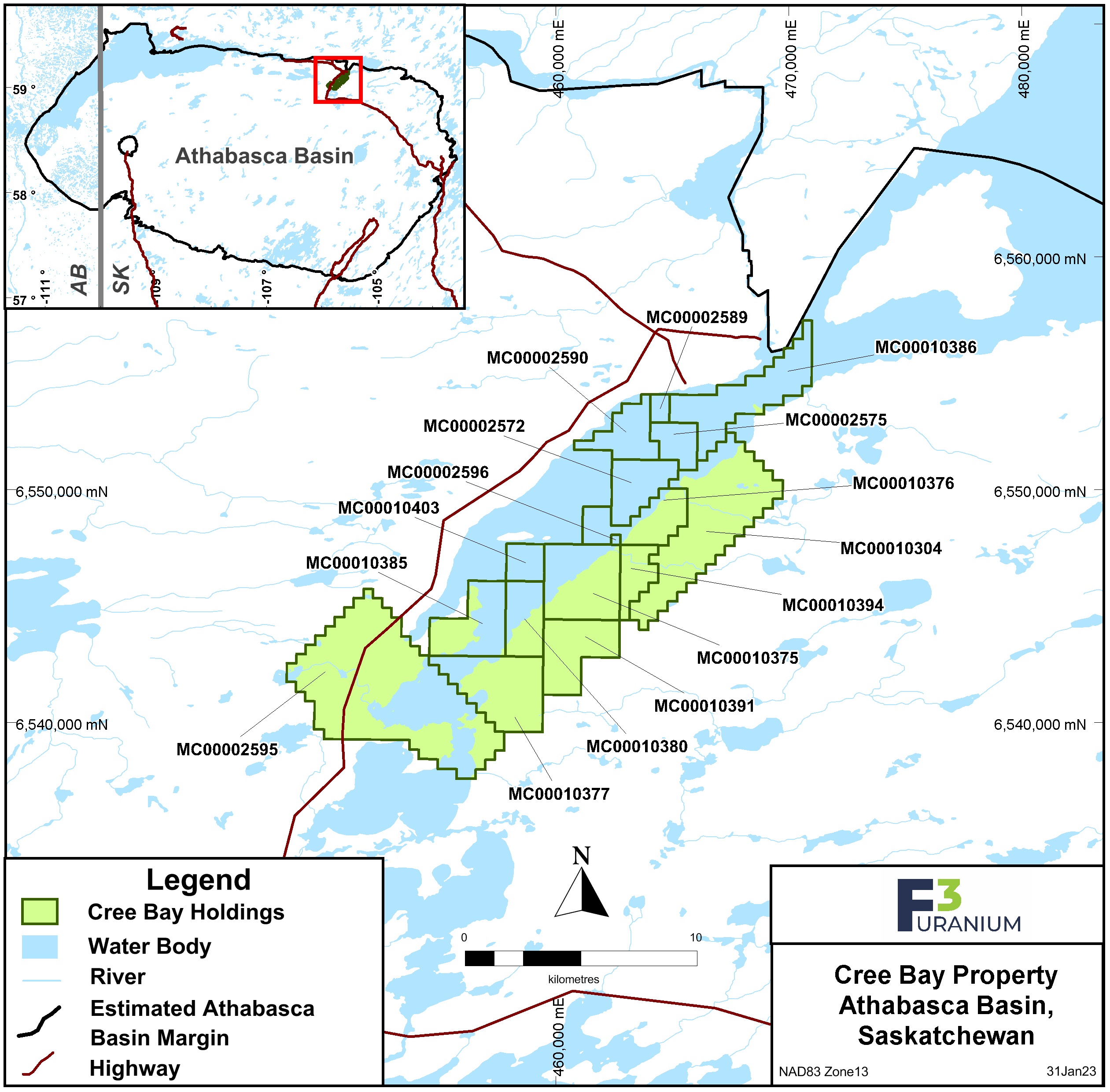
The Cree Bay property comprises 16 mineral claims totaling 14,080 ha located within the northern edge of the Athabasca Basin, Saskatchewan. F3 Uranium Corp. holds 100% ownership of the property. Claims were acquired by staking in December 2013, September 2014, and January 2018. The property is 20 km south of the town of Stony Rapids with seasonal road access to the west side of the property.
-
The property area has been prospected since the 1960's. In the 1970's, airborne electromagnetic surveys were first conducted by Kerr-Addison Mines and Shell Canada, followed by prospecting and drilling programs in the early 1980's by Shell and the Saskatchewan Mining Development Corp.
A previous MegaTEM survey indicated a wide conductive trend within magnetic low (Aphebian) units outlined by the magnetic TDX derivative.
In August 2015 a 4,214 km airborne high resolution magnetic & radiometric survey budgeted at $158,000 was carried out by F3 Uranium Corp. over the claims that were staked in 2014/2015. From an analysis on the potential field data, it was apparent that the geological setting of the project area is complicated, and that numerous lineaments are apparent that are related to contacts and structures between basement units.
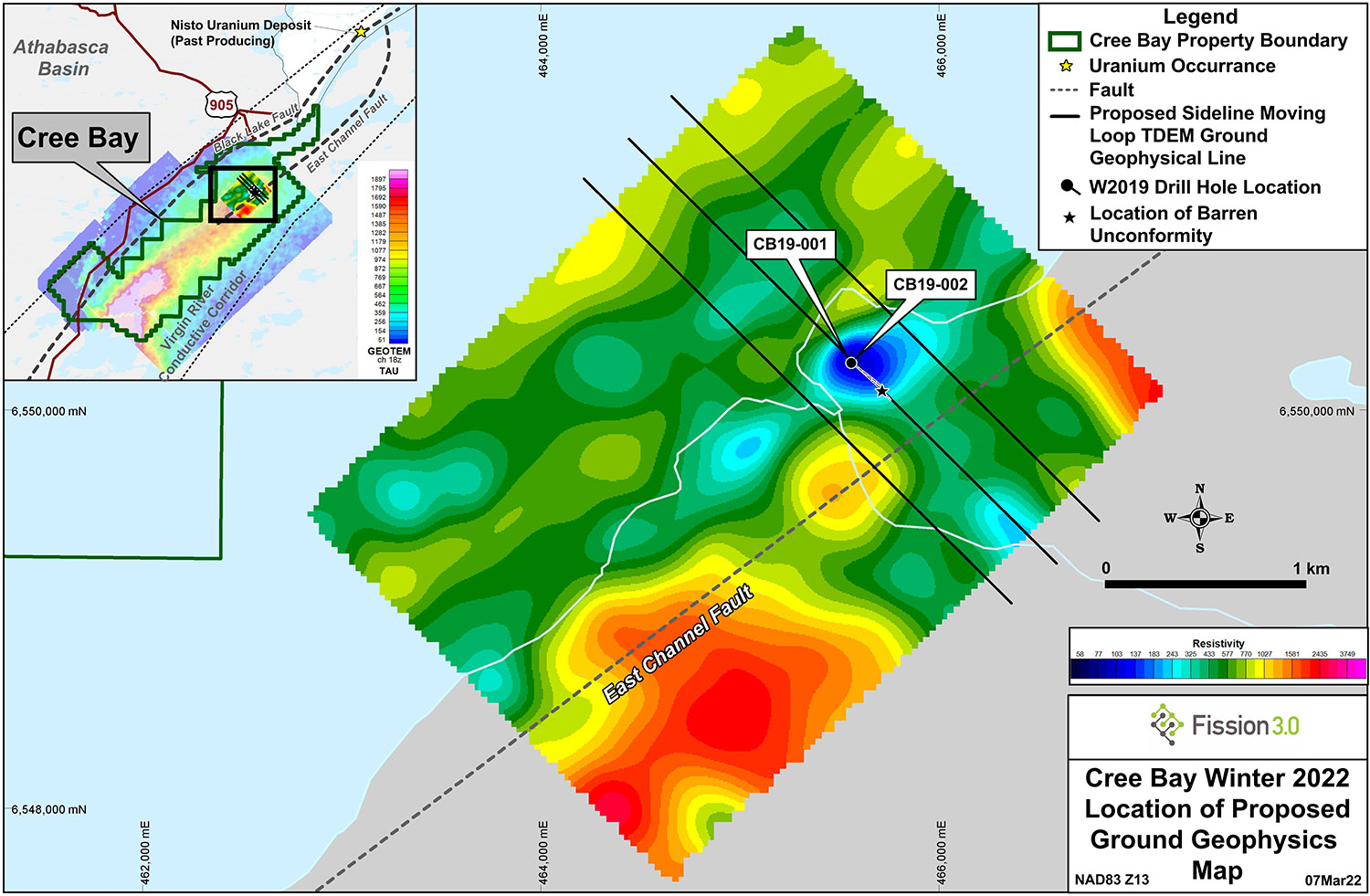
A DC Resistivity Induced Polarization ground geophysical survey conducted in September/October 2017 covered 24.0 km’s on two separate grids, which were centred on four km long sections of strong conductivity interpreted from a historic (JNR Resources Inc.) airborne Geotem survey. The ground survey was intended to resolve areas of hydrothermal alteration associated with Athabasca Basin style uranium mineralized occurrences, which could lead to drill target identification. The resistivity survey was successful in mapping apparent alteration chimneys in the lower sandstone column and in the upper basement rock units.
Qualified Person: The technical information in this website has been prepared in accordance with the Canadian regulatory requirements set out in National Instrument 43-101 and reviewed by Raymond Ashley, P.Geo., for F3 Uranium Corp., a Qualified Person.