
Key Lake Road Projects
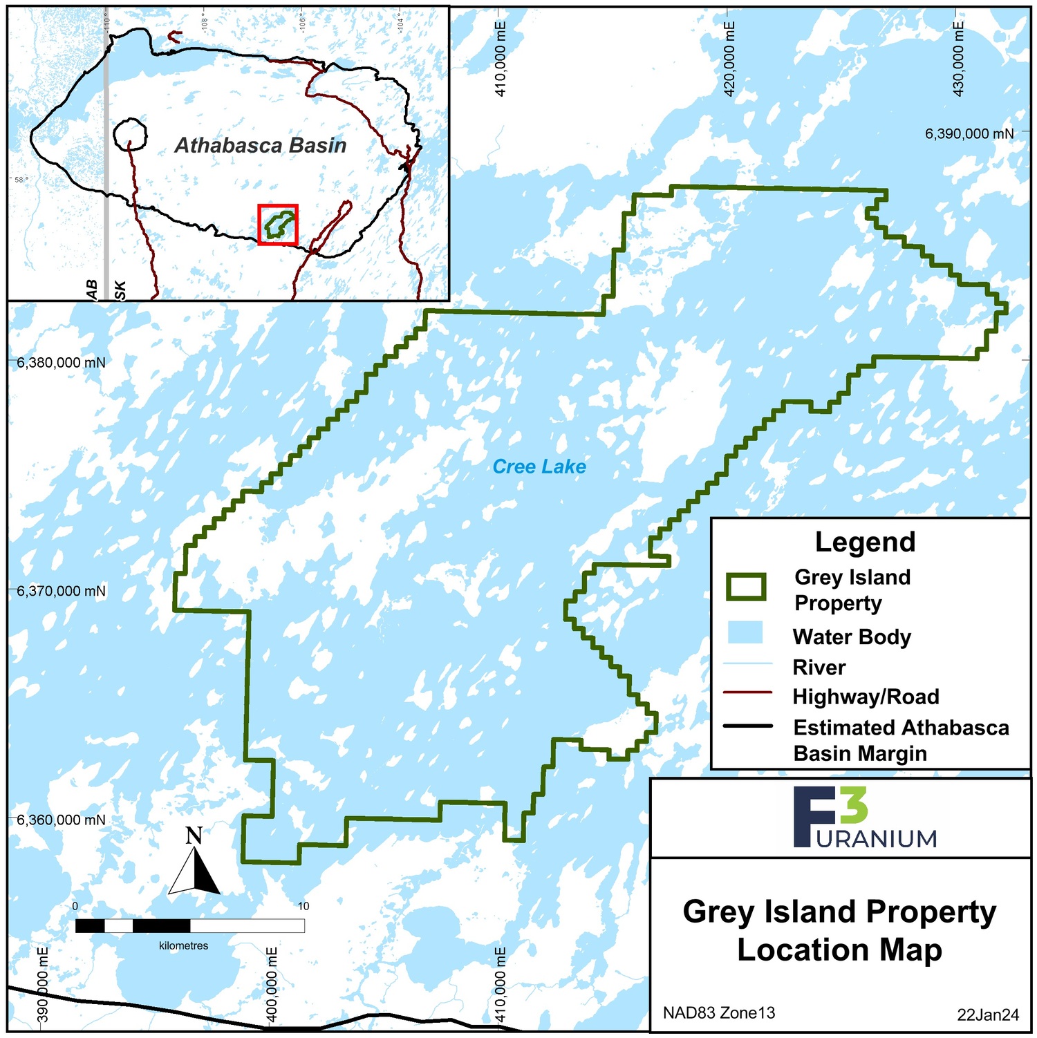
Grey Island
Key Points of Interest
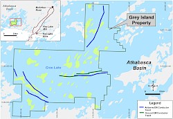
- Located 35 km east of a major northeast trending basement structural feature called the Cable Bay Shear Zone (CBSZ). Prominent crosscutting structures off of the CBSZ run through the Grey Island Property, intersecting with a northeast trending structure within the property boundaries.
- Overlies strong electromagnetic conductors that have been explored with just a single drill hole which encountered strong bleaching and alteration in the sandstone over 86m, and intersected pyritic and strongly graphitic basement rocks below the unconformity.
- Unconformity depth averages 270m from surface.
-
The project consists of 22 mineral claims totaling 47,912 ha in the southeast area of the Athabasca Basin, and is 100% owned by F3 Uranium Corp. It is located 70km northwest of the Key Lake mill and approximately 15km inside the southern margin of the Athabasca Basin, where the depth to the unconformity averages ~270m. The property is located halfway between the Key Lake Mine and Cameco's Centennial uranium deposit.
-
The Grey Island area has been prospected since the 1960's. During the 1980’s, large-scale regional prospecting and airborne and ground geophysical surveys were conducted by the Saskatchewan Mining Development Corp (“SMDC”).
From a geophysical perspective the property is attractive due to several interpreted basement EM conductors within magnetic low corridors (interpreted to be structural corridors) with flanking magnetic high features (interpreted to be granite gneiss). These are classic features in hydrothermal and structure related high grade deposits of the Athabasca Basin. The eastern part of the property contains an eight-kilometre ground EM conductor. Only one historic drillhole has tested this conductor and intersected strong bleaching and alteration in the Athabasca sandstone from 118m - 204m. Below the unconformity the hole encountered a pyritic, graphitic rock with 90% graphite locally. Anomalous uranium values of up to 2.16 ppm U were reported within a 20m section of sandstone immediately above the unconformity. The western part of the property contains a five-kilometre long conductor complex within a prominent magnetic low feature which remains untested. In 2008, two attempts by a previous operator to drill test this conductor complex were not successful and both holes were lost. The northernmost claims cover a magnetic low feature with an associated five-kilometre long conductor with no known reported historic drill testing.