
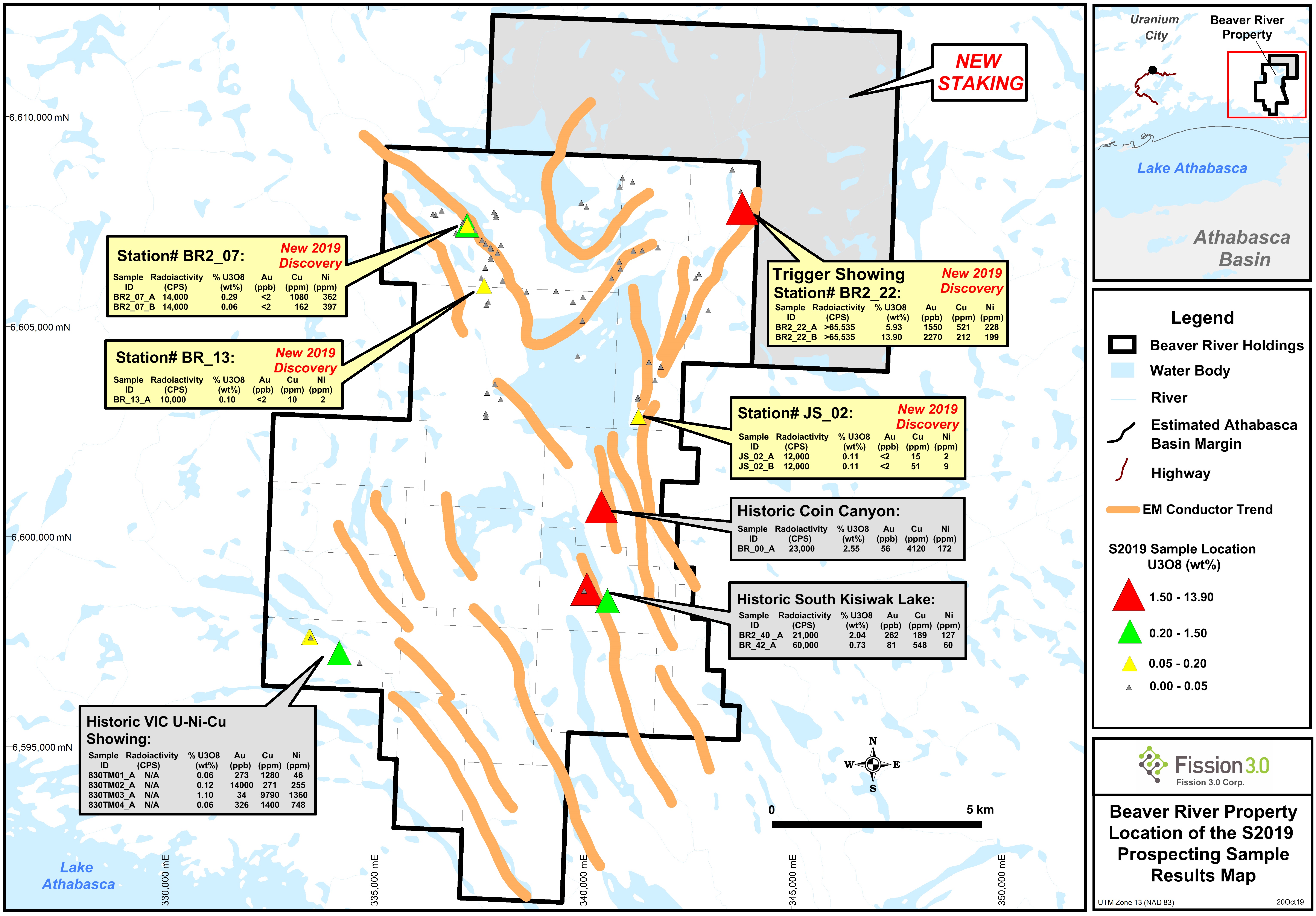
Beaverlodge Area Projects
Beaver River
Key Points of Interest
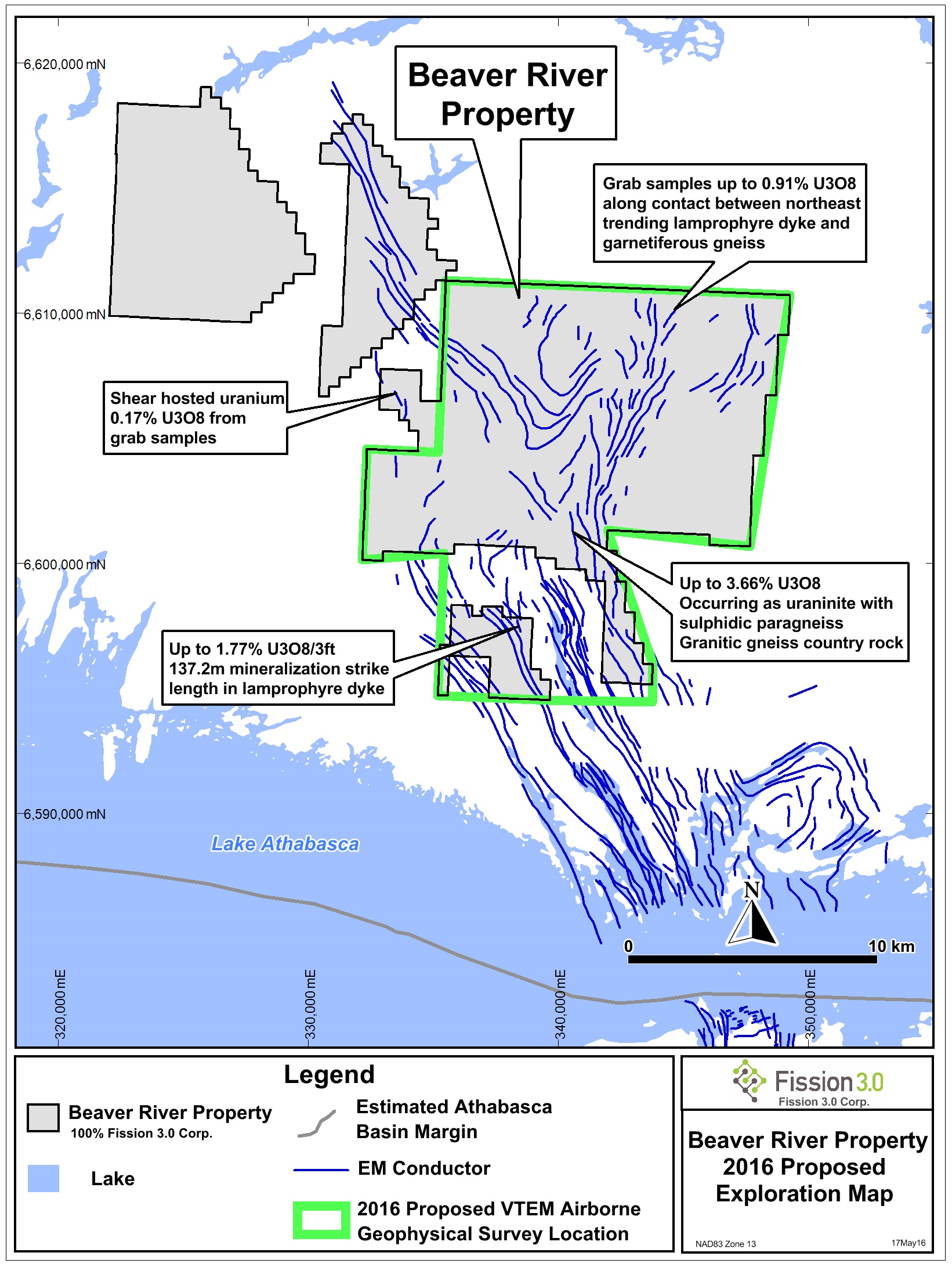
- Assays of 3.66% U3O8 (over 0.61m), 3.37% U3O8 and 2.93% U3O8 were recorded by Bayswater Uranium Corp. in 2007 from shear zones within a paragneiss unit in the central area of the property.
- Two historical uranium showings included in the three additional claims staked in October 2014:
- The Mathews Lake showing consists of pitchblende and yellow uranium stain in a northeast-trending set of fractures adjacent to and penetrating a 040° to 070°-trending lamprophyre dyke which cuts a north-northwest-trending amphibolite sill. The mineralization is noted over a strike length of 450 ft (137.2 m). The showing was trenched and stripped; samples assayed 0.23% U3O8 across 1.5 ft (0.5 m) and 1.77% U3O8 across 3 ft (0.9 m).
- The Cluster showing occurs in shear zones cutting a paragneiss sequence. Trenching revealed uranium staining, however assays are not available.
- A historical uranium showing was included in the four additional claims staked in December 2017:
- The VIC south uranium zone is described as uraninite and pitchblende mineralization in a quartz vein along an E-W fault within a mafic schist that has been mapped for over 1 km. Immediately adjacent and to the south of the vein is a ridge that contains up to 20% sulphides (mostly pyrite with minor chalcopyrite). The high grade vein was trenched and ran up to 25% U over 0.29 m.
- Grab samples from the historic trenches are reported to have returned up to 36.3% U3O8. Historic drilling of this zone returned 0.6m of 2% Cu, 1% Ni, 0.06% U3O8, 0.06 oz/ton Au and 0.70 oz/ton Ag.
-
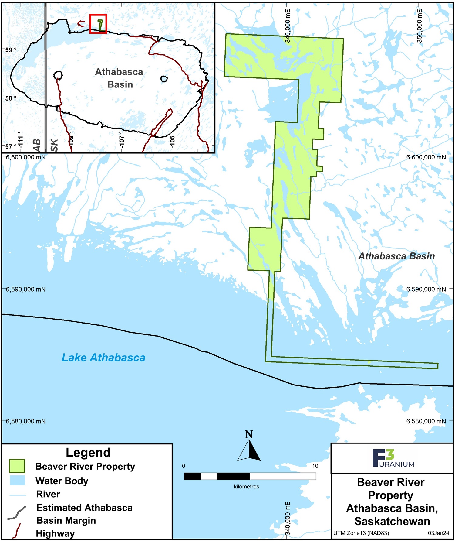
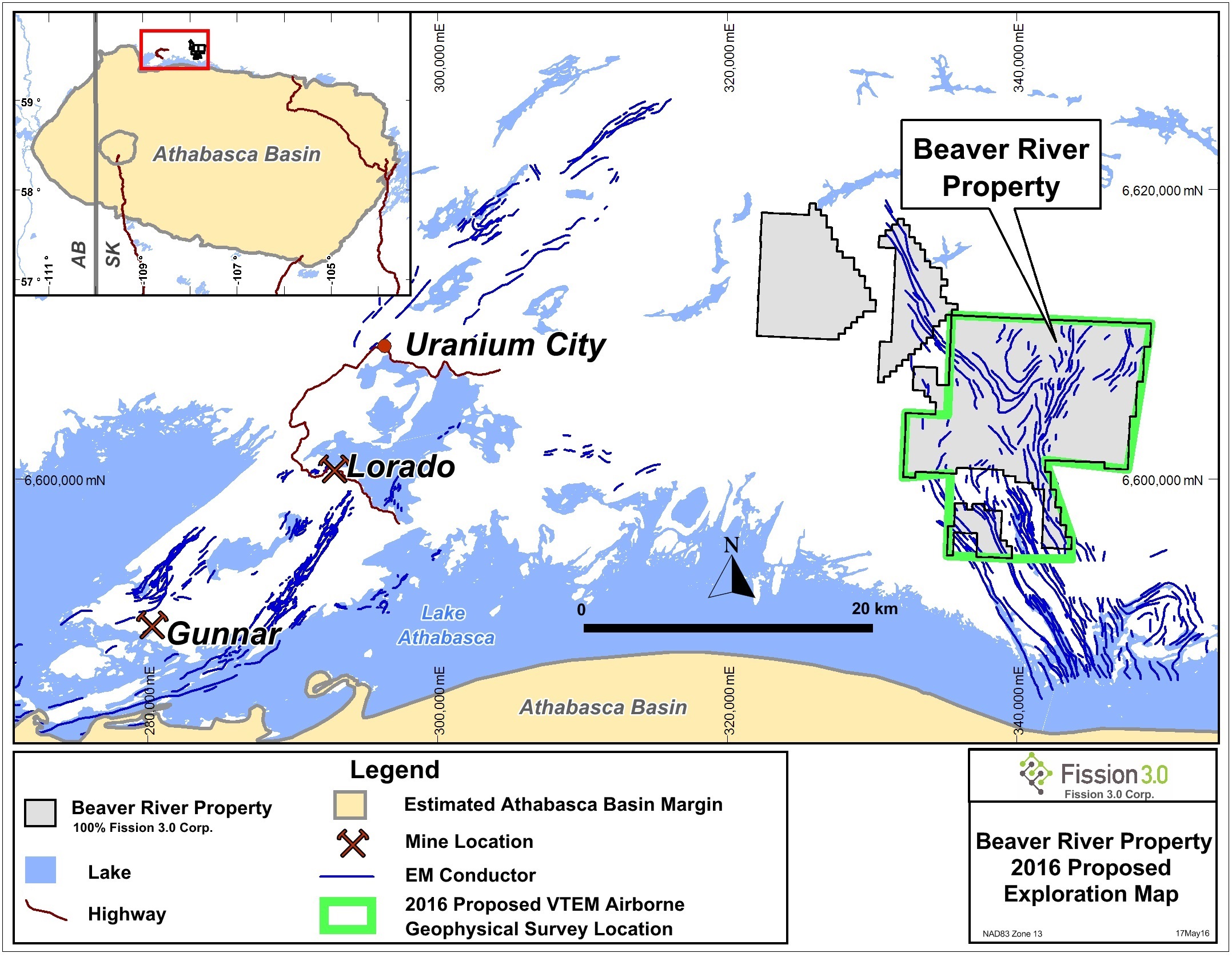
The project consists of 9 mineral claims totaling 7,599 ha, and is 100% owned by F3 Uranium Corp. The property is underlain by the Beaverlodge Domain of the Rae Tectonic Province, just outside the northwest edge of the Paleoproterozoic Athabasca Basin sediments. The town of Uranium City lies 40km to the west.
-
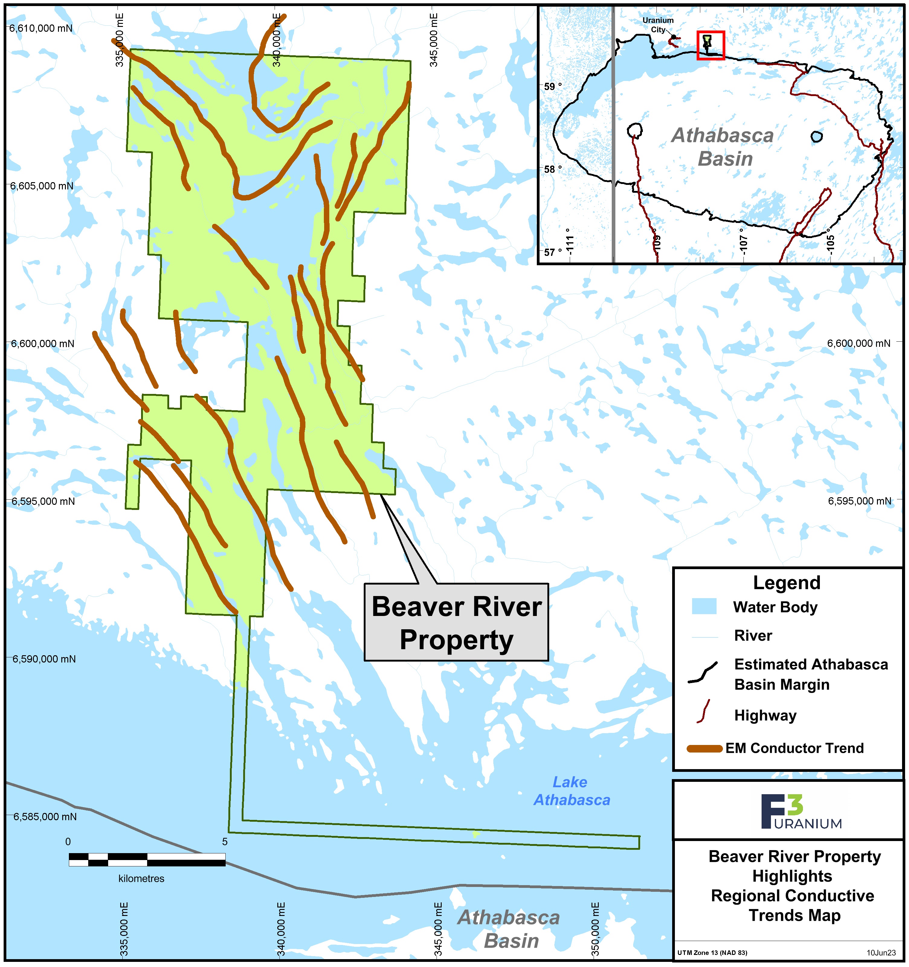
F3 Uranium Corp. commissioned a $193,000 airborne high resolution magnetic/radiometric survey consisting of 5,200 km over most of the property in August 2013, which was followed with a $146,000 helicopter-borne VTEM Plus survey of 880 kms. Radiometric anomalies from the 2013 survey require ground prospecting as follow-up, while the VTEM survey was instrumental in defining conductive packages over the entire project area. In excess of 258 km of conductors were defined by the VTEM survey. However, the interpreted results indicate complex conductor swarms which will require ground follow-up to establish drill targets. There are numerous areas of enhanced conductivity, as well as many areas of trend widening evidenced by increase in parallel multiple conductors and many offsets and termination points indicative of cross structure.
Qualified Person: The technical information in this website has been prepared in accordance with the Canadian regulatory requirements set out in National Instrument 43-101 and reviewed by Raymond Ashley, P.Geo., for F3 Uranium Corp., a Qualified Person.