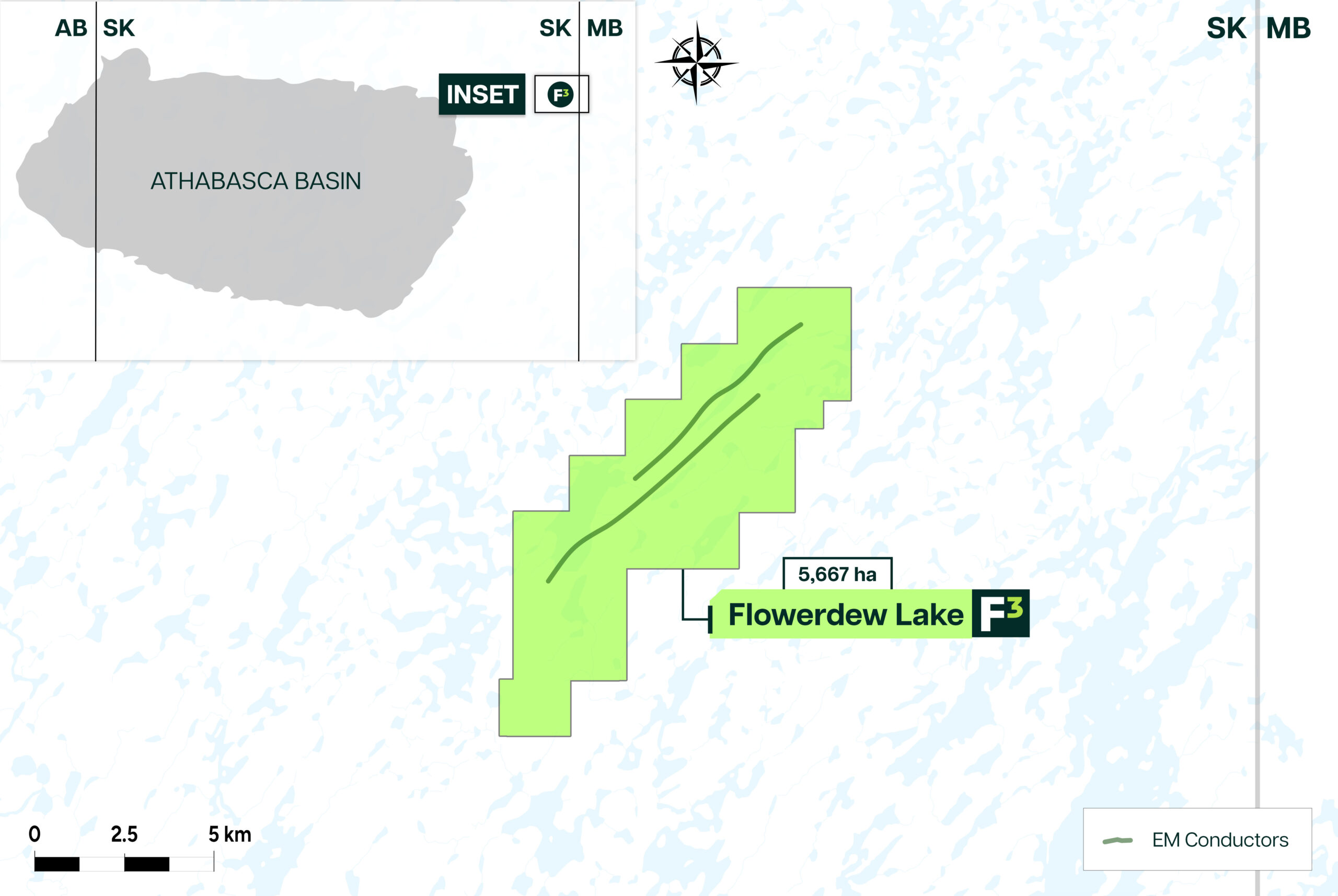
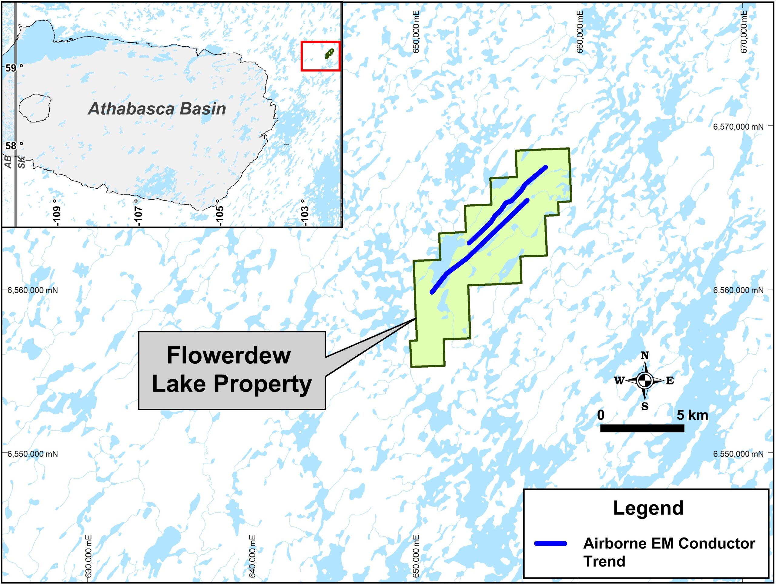


The property is situated along the Wollaston-Mudjatik domain transition zone, renowned for housing many of the Athabasca Basin’s major unconformity-type uranium deposits. This strategic location signifies its potential for significant uranium findings.
Geological mapping identifies the area as comprising semi-pelitic gneiss in close association with felsic intrusives. Additionally, it features interpreted basement formational EM conductors, with signs of cross-faulting indicated by discrepancies in magnetic, electromagnetic, and resistivity survey data.
The ground resistivity measurements reveal notable lows correlating with lithologic contacts, suggesting possible clay alteration zones. These areas are considered highly prospective for uranium precipitation. Remarkably, this promising area has yet to be subjected to drill testing, highlighting its untapped potential.
The property consists of four contiguous claims totaling 5,667 hectares cover an area that is approximately 13km by 4km in size. The property is located along the regional geological trend to the northeast of the Rabbit Lake, Eagle Point and Collins Bay uranium mines.
In the 1970s, Denison Mines and Amax Exploration focused on areas east and south of the claims. Triex Minerals and Roughrider Uranium conducted a DIGHEM survey in 2005 over Flowerdew Lake, identifying electromagnetic conductors and potential faulting. A 2006 induced polarization survey highlighted a resistivity low along a semi-pelite and granite gneiss contact, possibly indicating mineralization.
Subscribe to stay updated
Stay up to date on our exciting new discoveries, what’s going on in the uranium space, and new opportunities developing in the Athabasca Basin
Dev Randhawa is a seasoned CEO with extensive experience in resources, mining exploration, and energy companies. As the former CEO of Fission Uranium Corp., Mr. Randhawa, along with his technical team, led the high-grade uranium discovery at PLS in 2012. Recently, Paladin Energy made an offer of $1.1 billion to buy Fission Uranium.
In 1996, Dev founded Strathmore Minerals Corp., leading it until 2008. Mr. Randhawa spun off Fission Energy Corp. in 2007, focusing on uranium exploration in Saskatchewan. He sold major assets to Denison Mines in 2013 for $85 million, creating Fission Uranium Corp.
Dev has executed significant joint ventures, including a $50 million partnership with Sumitomo (Japan) and $44mil with KEPCO (Korea). In 2016, Dev negotiated an $82 million investment in Fission from CGN Mining. He holds a BBA from Trinity Western College and an MBA from the University of British Columbia.